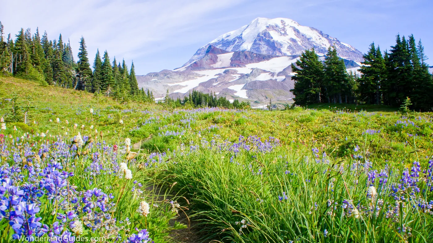
Mount Rainier · Mowich Lake
Spray park is best explored later in the summer when the snowline recedes to high elevations and wildflowers explode into their brief moment in the sun. When the weather cooperates, the scenery is exquisite offering expansive views of Mount Rainier as the hiker reaches nearly 6,400 feet in elevation...
8.3 mi (13.4 km) one-way to Carbon River
moderately difficult
+2600 ft, -4300 ft
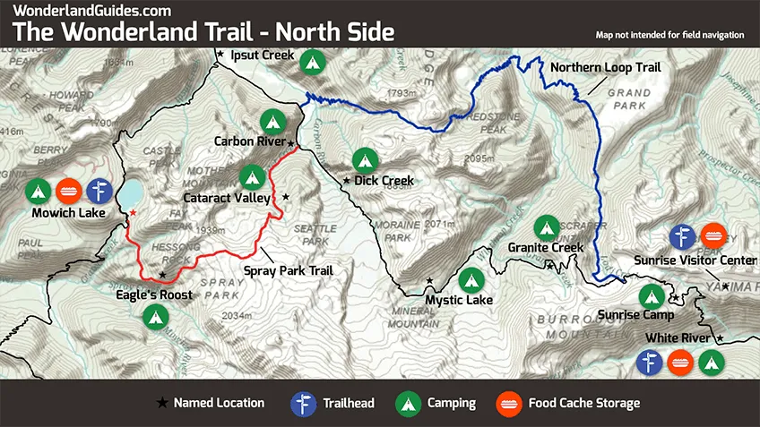
Starting at Mowich Lake, the Spray Park Trail climbs above the tree line to exposed subalpine meadows, crosses a permanent snowfield, and then descends back down into the lush forests of the Carbon River Valley.
Wilderness camps and distances from Mowich Lake
- Eagle’s Roost, 1.8 mi, 4,885 ft
- Cataract Valley, 6.7 mi, 4,620 ft
- Carbon River, 8.3 mi, 3,195 ft
Sections potentially without water
The west side of Spray Park can dry up toward the end of summer. There may be no convenient water sources between Grant Creek and Marmot Creek, a distance of less than 3 miles.
Hazards
Early season snow
Spray Park can be under snowpack until late summer, making route-finding difficult and footing challenging. Always check current trail conditions before hiking this section.
Bad weather
Spray Park faces to the northwest. It bears the brunt of most of the bad weather that rolls in off the Pacific Ocean. Above the tree line, the trail is mostly exposed. It’s a miserable place to hike when the weather is bad.
Sun exposure
Be vigilant to protect against U.V. damage to both skin and eyes. The trail is exposed and some sections may be across snowfields, amplifying U.V. exposure. There was probably a case of snow blindness behind the naming of nearby Cataract Valley Camp.
Trail notes
Hike to Eagle Cliff (1.6 mi)
From the Mowich Lake Campground, backtrack a short distance down the Wonderland Trail to reach the junction with the Spray Park trail. From here the path flanks Fay Peak and crosses Lee Creek before rounding the base of Hessong Peak.
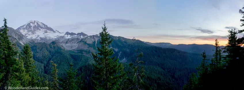
Eagle Cliff, is a fenced viewpoint a thousand feet above Spray Creek and the north fork of the Mowich River.
Eagle’s Roost Camp (1.8 mi, 4,885 ft)
Eagle’s Roost Camp has 7 standard campsites and an outhouse, and is a nice camping alternative to Mowich Lake.
Spray Falls (2.0 mi)
The Spray Falls trail travels 0.1 mi to the base of Spray Falls. This is a spectacular 354 ft veiling horsetail falls with an average flow volume of 60 cubic feet of water per second. Use caution on the slippery rocks.
Spray Park to crest (2.7 to 4.2 mi)
From Spray Falls the route switchbacks steeply up the hill crossing Grant Creek before reaching the gentler slopes of Spray Park. From here it’s a steady and pleasant climb through gorgeous subalpine meadows.
Watch for the way-trail to Hessong Rock near the 3.6 mi mark. This short scramble is best in late summer due to lack of snow, and offers a nice perspective of Spray Park.
Permanent snowfield (4.3 mi, 6,300 ft)
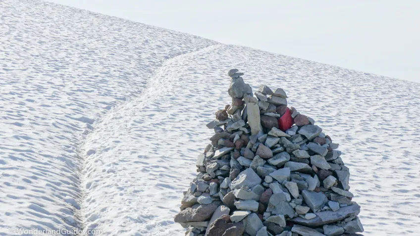
Near the high point of the Spray Park Trail you’ll reach a permanent snowfield. When the trail is visible, look for cairns.
Mist Park (4.9 mi)
Descending toward Carbon River, the trail skirts the cliffs above Mist Park. The views are lovely.
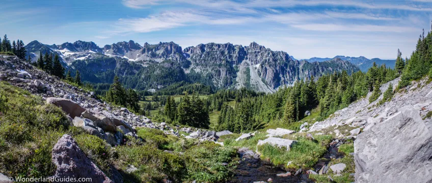
Marmot Creek (5.6 mi, 5,200 ft)
A mile above Cataract Valley Camp, the trail cross the lovely Marmot Creek. It follows this drainage until it meets the Wonderland Trail, more than 2000 feet below.
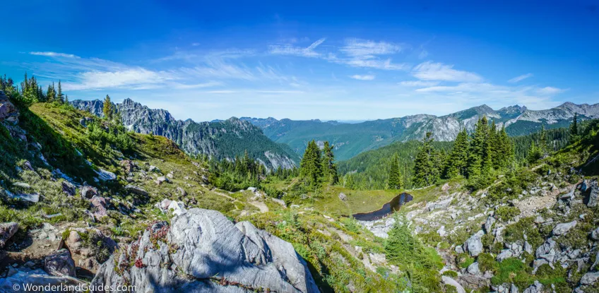
Cataract Valley Camp (6.7 mi, 4,620 ft)
The descent is knee-jarring and difficult and Cataract Valley Camp makes a welcome stopping point, midway to the bottom.
Cataract Valley Camp has 6 standard sites and 1 group site. It is nestled in the forest along the hillside.
Carbon River Camp (8.3 mi, 3,195 ft)
Carbon River is a small and comfortable camp. It has 4 standard and 1 group site tucked out of the wind along Cataract Creek. Here the Spray Park Trail rejoins the Wonderland Trail.
Side hikes
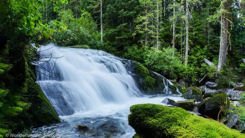
Spray Falls
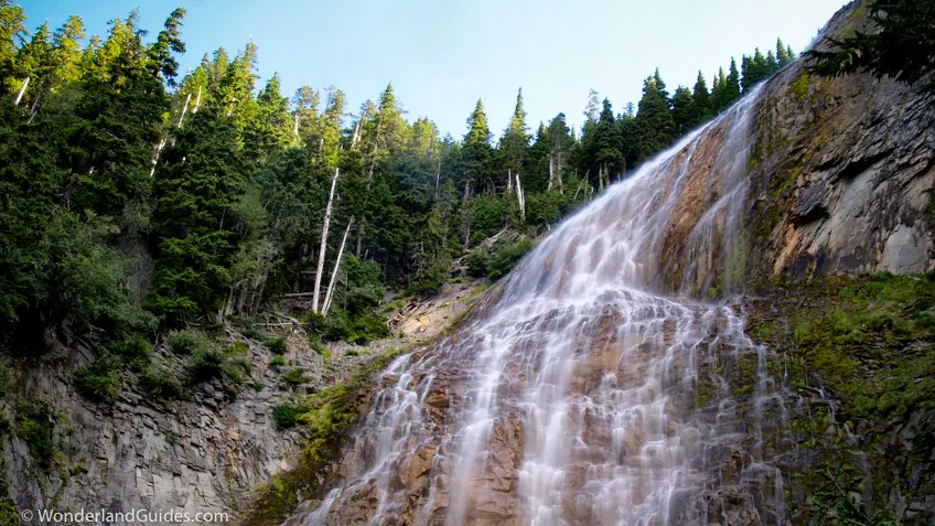
Spray Falls is a must-see when passing by. The way-trail is only 0.1 miles long. This impressive waterfall delicately veils the face of an andesite cliff and is bordered by fir trees and thick mosses.
Hessong Rock
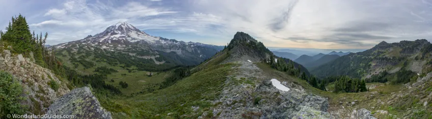
This is a short but somewhat strenuous half-mile scramble to an expansive overlook of Spray Park and the Mowich Valley. The unmarked trail can’t be missed where it junctions the Spray Park Trail at N46°55’20.25”, W121°50’15.48”.
The trail heads northwest, reaching the valley wall in less than a quarter mile. Over the next 1000 ft, the trail makes a steep climb 500 ft in elevation to the ridge. It’s an easy class 2 scramble, but likely too steep to do when snow is on the hillside. Most people stop once they reach the ridge. You can follow the trail around the west side of the ridge to get to the peak via a class 3 scramble.
Photographing Spray Park
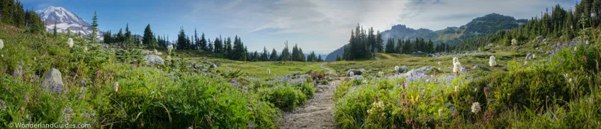
The lower portions of Spray Park look best in the late afternoon just before the sun dips behind Mount Pleasant and Hessong Rock. Spray Park itself is not a good sunset location as it gets cast into the shade late in the afternoon. It can be frustrating, because right as the light starts to get good, a shadow blankets the valley.
Earlier in the day, views of the mountain will be into the sun. Wildflowers look great when they’re somewhat backlit, so you can compensate for lackluster lighting on the mountain by making wildflowers the primary focal point.
To get the best sunset light, move to the crest or further north. The descent toward Carbon River is gorgeous in the late evening, with views of Cascade foothills stretching toward Seattle.
Interesting Geology
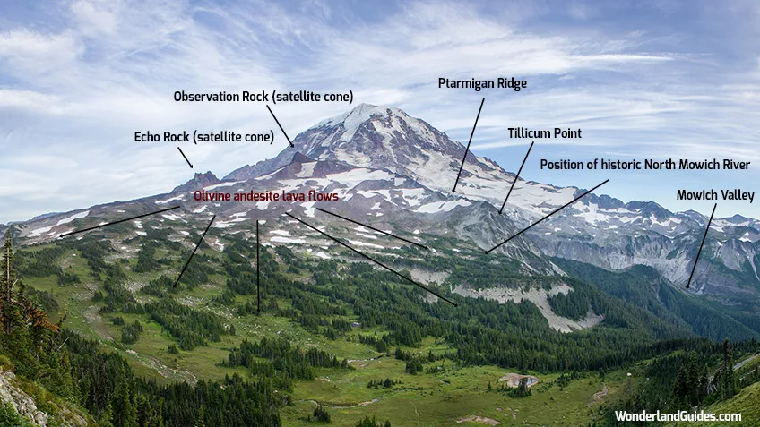
Hiking through Spray Park, it’s hard to miss Observation and Echo Rocks looming overhead. These are the remains of two satellite cones that erupted after Mount Rainier was near it its current size. These erupted layers of olivine andesite lava that flowed down between the Carbon River and Mowich valleys. Spray Park rests on what used to be the North Mowich Valley. This filled in and formed the relatively gentle slopes of Spray Park. The Mowich River used to fork below Ptarmigan Ridge.
Logistics for visiting
Besides the drive-in entrance fee to Mount Rainier National Park, no permit is required for day hiking Spray Park.
Overnight trips require Wilderness Permits. These can be obtained via reservation (apply March 15 to April 1) or by walk-in.
All camps along the Wonderland Trail are in high demand throughout the hiking season. When making the two/three day loop hike over Spray Park and Ipsut Pass, the largest wilderness camp is at Ipsut Creek, and it’s most likely that you can get a walk-in permit here.
Front-country camping is available on a first-come first-served basis at Mowich Lake.
For more information on obtaining a permit refer to this section of the guide for the Wonderland Trail.